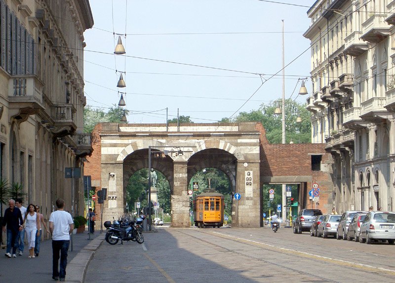
There is a long (almost) straight road which runs from very close to the Duomo in the city centre to an arch known as Archi di Porta Nuova.
On looking at the streetmap it seems that this long road changes its name several times; this photograph was taken at the northern end where it is known as Manzoni.
Underneath the road is line M3 of the Milan underground railway (metro / subway) system, part way along this road is a station named Montenapoleone (also known as M.te Napoleone) which is located next to a road of the same name that was named in honour of the man who lead an army (and empire) which we Brits eventually beat. (The station is not illustrated here, as there is nothing of special interest to see).
The double archway is a former gate that was part of the 12th-century city wall. It was reinforced and embellished by Azzone Visconti (1330-39), and consisted of two arches flanked by towers. In the 15th century it was partially demolished and incorporated into other buildings, and then restored in 1861. It was further restored in 1931 with architectural changes. The faces in the left and right side walls can be better seen in the next images.
As is also seen in some of the following images, just inside the city bound archway is CCTV (etc) equipment - I saw similar in several other places around the city too and would guess that this is part of an enforcement system for the city centre restricted traffic zone.
citytransportinfo is also here:
share this page with your friends!
E & OE. All images © copyright 2007 Simon P Smiler.
Photo album created with Web Album Generator


